
•Discover•
Day in the Life
The beginning of this project started off in groups. My group tried to find a general area in life that could use improvement. We started off each doing a “Day in the Life” to identify low-points in our day to day life. I wrote down everything I did for one day and then went back and tried to find areas that could use improvement.

Low points = Snoozing alarm, finding socks, using my credit card in the cafe
NCR Business Sector Research
NCR has 10 business solutions: Financial Services, Retail, Restaurants, Cinema & Theaters, Stadiums & Venues, Travel, Telecom & Technology, Small Business, Public Sector, and Smart services. The group allocated each member to research 2 of the business solutions. I researched Small Business and Public Sector solutions, focusing on potential business opportunities based on their current competition. I wanted to identify key components that would remain important in the year 2025.

••Define••
International Student Interviews
The international students in the group (including myself) all had challenges with traveling in a foreign country that arose during the "Day in the Life". The member that researched NCR Travel solutions agreed that traveling would be a good area to research further. To gain insight into the challenges with traveling, I interviewed 5 international students who all experienced some struggles during their study abroad. I kept the interviews rather broad to not create leading questions.
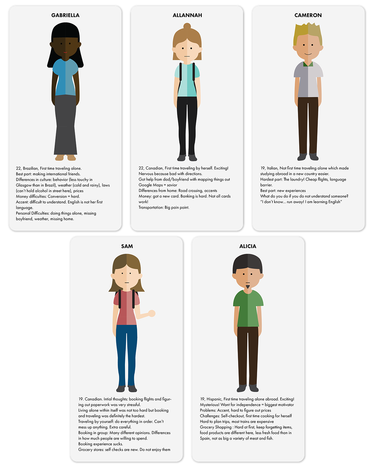
The themes that emerged are...
Money
Language (New)
Grocery Shopping
Self-Checkouts
Confirmations
Personal Research
After interviewing the 5 individuals, I wanted to gain more insight into the challenges of traveling. By chance, I happened to be traveling to Paris the following weekend. I filmed my travel excursions to record any personal struggles that I identified . I also created screen recordings to exemplify all of the different tasks that I needed to do on my phone.
Big Insight: There are 3 stages of Traveling...

...And I will focus on Navigation

Design Criteria

•••DESIGN•••

Initial Sketches
The first ideas I had revolved around the users cell phone since I learned that people depended so heavily on their phones during travel.

Design Direction: Technology
When I first started ideating, I centered my ideas around cell phone attachments. My original thought was that since travelers are already so dependent on their phones, I would create an attachment that could alleviate the other pains of traveling. The device would help direct the travelers to their final destination using the cell phone as a way to communicate information. However, I realized that a huge “low point” of traveling is being on the phone so much. Why would I design a product that would further push users to be on their phones even more? I realized how counterintuitive my design was. Given this, I started researching other forms of technology that presents information and I came across foldable displays. Samsung just released a new phone that will come out in 2020 that is foldable. I use this as technology from which to base my design.

After discovering foldable technology that could “roll up like a newspaper”, my mind jumped right to a virtual map concept. I wanted to design a flexible screen that is transparent yet displays upcoming directions for users on the screen. Users could rent the map at airports and train stations for the duration of their travel. Upon returning, they can return the map at a drop off location. It would use modern technology but incorporate the user experience of opening a traditional map and using it for navigation.

Refining sketches
User Research
After creating initial map sketches, I realized that I could go forward with the design in one of two ways : a folding map or a scrolling map. In order to quickly test which form users associate with maps, I posted instagram polls on two different accounts and got over 200 responses. The clear consensus was a folding map so I moved forward with this design for my final form.

Further Concept Sketches

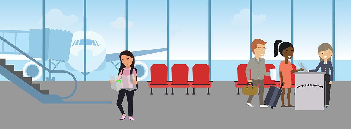
Explanation of Final Concept: MODERN MAP
The final concept is an electronic map using E-Paper that helps people navigate while traveling. It is rented out for the duration of the user’s travels. The user can rent the map at airports and train stations and return it after their trip has ended. The target user is someone who is traveling to a new place. In order to target the biggest audience, this map is designed to be universal so anyone can use it, regardless of one’s background. To capture the user experience of using a real paper map, the product folds up in an accordion fold style and can be easily compacted into a backpack or bag. The map display is transparent which allows users to still take notice and admire the foreign landscape around them.
User Flow Diagram
I created a user flow diagram for the interface of the map. I started off sketching my ideas roughly to brainstorm how a user would interact with the product. I then digitally showed the user interaction using a User Flow Diagram.

User Interface Example
The Modern Map has a simple user interface. All of the services offered from this product can be accessed from the home screen. The user can use the map to get directions somewhere, translate any audio they hear but do not understand, figure out money conversions, and view their upcoming travels.

Render (In Context)
The renders serve to exemplify what the Modern Map could look like. The transparent display of the product allows the user to still view the surrounding scenery.


If this project were to go to market, more ideation would need to occur in the actual form and engineering of the product would need to occur.